|
Walking on
Exmoor and the Quantock Hills |
||||||
|
|
|||||||
Menu
|
About the site
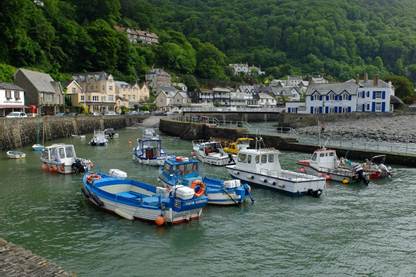
Lynmouth This site presents
walking information and routes in the Exmoor and Quantocks region in west
Somerset and north Devon, stretching from Croyde and Mortehoe on the Devon
coast across to Kilve and Lilstock in the east, and down to Bampton in the
south. Please read the walks introduction first, then for walk descriptions either use the linked
map at the bottom of the introduction page or go to the individual sections
in the menu on the left. The site is the result of over 2500 miles of walking on Exmoor
and the surrounding area. It started
in 2016 as a project for a book with 35 walks. Before long I realised that I would need at
least 50 routes to do the area justice, and after setting the web site up in
2018 I soon had over 80 – far too many to fit into a pocket book, and
probably better anyway as a series of pdf leaflets that can be printed as
needed or downloaded to phone or tablet.
There are now 100 main walks, many with shorter or longer alternatives
giving over 250 routes to choose from.
All the routes have been walked at least twice and all have been
walked since 2020 (the date is at the end of the description). The descriptions do become out-of-date, but
things change slowly on Exmoor and most of the alterations relate to things
such as stiles being replaced with gates, new fence lines, woods being felled
(or regenerating) and the occasional change to a right of way or physical
path on the ground. Particularly on
older walks be aware that there may be changes and be prepared to work things
out on the ground if needed. Ideally
take a Croydecycle or OS 1:25000 map as well to compare with the sketch map
in the instructions. If you notice any
changes from the route descriptions or maps do send me an email at editor<at>exmoorwalker.uk
and I will update the relevant walk as soon
as I can. Now for the disclaimer. The information on this site is provided freely
and in good faith to help users explore the Exmoor and Quantocks region, and
it is only occasionally updated. I’m
not a professional walk leader, none of it is guaranteed in any way and there
will be errors and omissions. It is
your responsibility to use the site sensibly, to read and take note of the
warnings relating to specific walks or walking in general (including use of
GPX files), to assess how suitable each walk is for you, and to take into
account (among other things) your level of fitness, surefootedness and head
for heights, as well as the weather conditions and where relevant the tide times. I sincerely hope you don’t have an accident
or injure yourself, get lost, experience hypothermia, dehydration or
sunstroke, get cut off by the tide, arrive at the café just as it shuts, or
miss the last bus (or find that it’s been withdrawn from service), but I
can’t take any responsibility if you do! Finally, copyright. Everything on this site is the property of
the site owner. You may print, copy
and distribute anything for personal or non-chargeable use (e.g. walking
groups, guest accommodation, tourist information) provided that it is acknowledged as coming from
exmoorwalker.uk.
All text, photographs and maps © Stan Lester 2025 |
||||||
|
|
|
||||||