|
Walking on
Exmoor and the Quantock Hills |
||||||
|
|
|||||||
Menu
|
Introduction to the walks
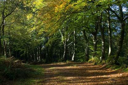
Path near Croydon Hill Over a hundred main
walks are described, most between 6 and 12 miles, spanning the coast from
Croyde to Lilstock, the Exmoor National Park, the Quantock Hills, and some of
the country in between and to the south.
Many walks have shorter alternatives or they can be linked
together to form dawn-to-dusk routes.
Including the alternative and shorter walks there are over 250 routes
to choose from, ranging from strolls around villages to hard hikes across
open moorland. ► Introduction to the region (pdf booklet) Walks are graded
from yellow (easiest, mainly the shorter alternative walks) through green and
blue to black (most strenuous). If you
are not an experienced hiker start with one or two of the yellow or green
walks and see how you get on. There
are no 'mountain' walks in the region, but several walks cross open
moorland without clear paths and require some navigation skills. Many harder walks also have easier
alternatives, and these are listed in the downloadable catalogue. A red exclamation mark indicates where a head
for heights may be needed. None of
these walks have extreme exposure and some have alternative routes that avoid
narrow paths above drops, so don’t automatically rule them out if you suffer
from vertigo or are not confident on narrow paths above heights. (A blue exclamation mark indicates a tidal
stretch or a stream that can be difficult to cross after heavy rain, and
an orange-brown 'tussock' symbol an area of open moorland that may be
difficult to negotiate when the ground is waterlogged or after strong
growth). Check the public right of way
maps for Exmoor, Somerset or Devon (see 'useful links') for an update on any path
closures or problems. Please note that
the times in the descriptions are continuous walking times. These are based on a speed of 3mph, with
allowances for going uphill and difficult terrain. The walks also have an estimated total
time, but how accurate this is depends on your walking speed and how much you
pause or explore along the route. Many of the routes
are circular; where they are not, there are usually public
transport connections between start and finish, at least on weekdays and
often also Saturdays. A few linear
walks don't have bus connections and you will need to organise your own
transport; a few also link together to make longer circular walks. Either way, I suggest taking transport from
the finish to the start at the beginning of the walk. That way around you avoid a race to catch
the bus, or a long wait after arriving too early. Many of the walks can be reached by bus or
train, particularly if you are based in one of the larger centres in the
area; the details (but not timetables) are in the walk descriptions. Do make sure you
prepare properly for walks and are aware of dangers - these can include cars,
cattle, snakes, ticks, the landscape itself, and the weather. Read the walk safety sheet and follow the
country code. ► Walk safety, Country Code, disclaimer The links under
each of the nine walk sections (and on the interactive map below) take you to
a PDF document containing the route description, including a map and details
of any alternative or shorter walks. ► Map of the Exmoor and Quantocks
region with links to walks ► Key to symbols on
the maps in the walk descriptions ► Grid references and using a map
and compass
All text, photographs and maps © Stan Lester 2023 |
||||||
|
|
|
||||||