|
Walking on
Exmoor and the Quantock Hills |
||||||
|
|
|||||||
Menu
|
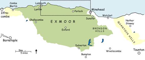
The Exmoor coast: Lynmouth to Minehead
This page covers
the coastal area from Lynmouth to Minehead.
This stretch consists of two distinct uplands, one rising from
Lynmouth to Countisbury Hill and continuing via wooded combes to Porlock
Hill, while the other, from Bossington Hill to North Hill above Minehead,
forms a more-or-less continuous ridge.
Wedged between is the Porlock Vale, one of the few flat parts of
coastal Exmoor. Most of the walks in
the area require some effort, though gentler routes can be found from
Lynmouth, around Porlock and on North Hill. Many of the walks
link up to make longer circular or linear walks: there are details in the
walk instructions. Click the walk name
to download the route. Read the walk safety information, and click for a key to the symbols used on the sketch maps in the instructions. Notes: ·
There have been
some changes to the Coast Path at Glenthorne (link between
walks 19 and 21), Worthy, and North Hill and Hurlstone Point
(walks 25 and 26). These don’t affect
the walks materially, but where I refer to the ‘Coast Path’ in the
instructions this may now be incorrect.
·
All-day off-road parking
in Lynton and Lynmouth (including Watersmeet) is now £10-16. From October to Easter there is all-day
on-street parking if you can find a space. SW1 Short walks from Watersmeet 14 Lynmouth, Lynton and the
Valley of the Rocks ♦♦ 5.6 mile circular 15 The East and West Lyn
gorges ♦♦♦ 6 mile circular 16 The Lyn hamlets, Barbrook and
Cheriton ♦♦! 6.1 or 7.5 mile circular 17 Lynmouth, Countisbury and
Watersmeet ♦♦ 5 mile circular 18 Countisbury and Foreland
Point ♦♦! 3.2 mile circular 19 Countisbury to County Gate via
the Coast Path ♦♦/♦♦♦! 4.7 mile linear, bus connection or walk 20 20 County Gate to Countisbury via
the East Lyn ♦♦/♦♦♦! 5.4 mile linear, bus connection or walk 19 21 County Gate, Oare and Culbone ♦♦♦♦ 9.1 or 9.8 mile circular 22 Porlock Weir and Culbone
Church ♦♦ 5.2 mile circular 23 Porlock, Hawk Combe and
Porlock Weir ♦♦♦ 8.4 mile circular 24 Porlock, Bossington and Horner
♦♦ 8.4 or 7.6 mile circular 25 Bossington, Selworthy and
Allerford ♦♦♦! 7 mile circular 26 North Hill and Selworthy
Beacon ♦♦ 7 mile circular 27 Minehead and North Hill ♦♦ 4 mile circular 28 Minehead, Bratton Ball and
Woodcombe ♦♦ 6.2 mile circular More Minehead area
walks in the Brendon Hills section.
All text, photographs and maps © Stan Lester 2022-2026. |
||||||